
http://www.geo.mtu.edu/volcanoes/central_america/nicaragua/cerro_negro/gvn/images/2012neg4.jpg
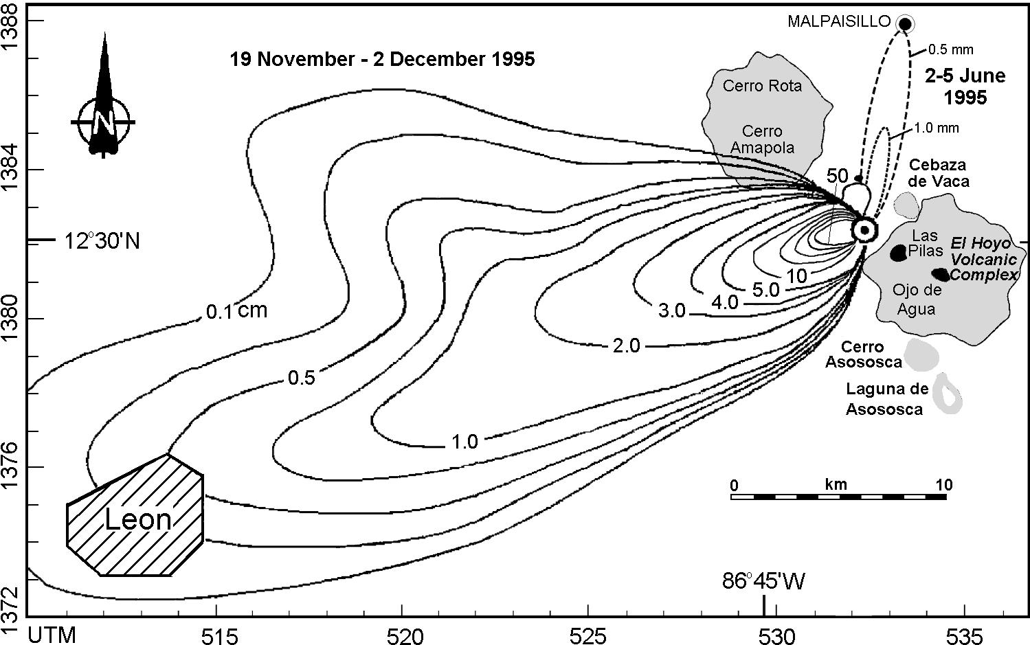
An isopach is a line on a map that connects point of equal thickness of a geological stratum formation or group of formations. Above is an Isopach map of ashfall from Cerro Negro from November 19th to December 2, 1995. Isopachs within the 5.0 cm limit are at 10-cm intervals, up to 50 cm closest to the crater.
No comments:
Post a Comment